Sunday, January 27, 2013

Le Col des Chasseurs (par le Col de la Cicle) 2520m


FOR US LANGUAGE VERSION CLICK HERE

Une belle sortie organisée par Phillipe Dilloard du CAF de Chamonix. C’est une traversée qui part de Notre Dame de la Gorge au col de la Cicle puis, immédiatement au sud du col de la Cicle, une petite escalade mixte (crampons aux pieds selon les conditions), puis une très belle traversée jusqu’au Col des Chasseurs. Tout ça dans un grand décor avec des vues somptueuses aussi bien coté Beaufortin que coté Mont Blanc.

Massif : Beaufortin
Carte topo : 3531OT
Orientation : N (pour le descente dans le couloir)
Altitude de départ : 1200
Altitude arrivée : 2520m
Dénivelé cumulé : 1585m

Accès voiture:
Du Fayet continuer vers Saint-Gervais puis vers Les Contamines et garez-vous au dernier parking publique  env. 200m avant l'Eglise de Notre Dame de la Gorge (compter env. 30 min à partir du Fayet).

Accès trace:
Chausser au parking puis s’engager sur le pont de la piste de Nordique puis engagez-vous sur votre droite. Continuer tout droit laissant l’Église gothique sur votre droite et prendre la voie Romaine qui ici commence la montée. A noter qu’occasionnellement la partie basse de cette voie romaine peut être gelée au point de rendre les crampons indispensables !
Voici les photos prises hier (cliquer pour agrandir) ainsi que « the movie »:


Monter au col de la Cicle puis traversr jusqu’au Col des Chasseurs
Filmé et produit par notre réalisateur hors-normes : Jean-Charles Granet (aussi du CAF Chamonix) . 
Pour voir le film cliquer ici puis le lancer une fois sur la page du CAF.

Francois, Philippe et Jean-Charles en pause aux chalets des pâturages
 de la Balme juste après la sortie des Bois de la Rollaz
 
Petite escalade mixte mais il vaut quand même mieux éviter de lâcher prise…

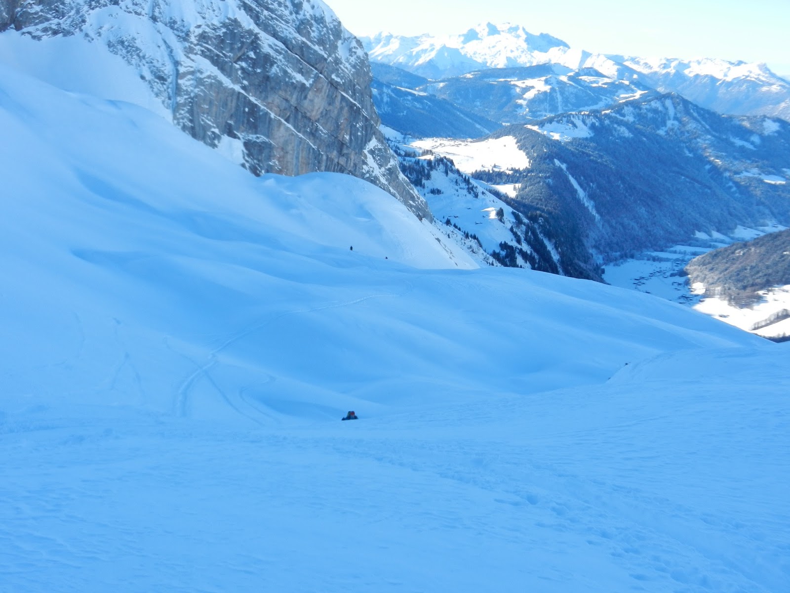
Vue coté Beaufortin…
...et coté Mont Blanc
La descente du Col des Chasseurs 


Col des Chasseurs (via Col de la Cicle)


POUR LA VERSION FRANCAISE CLIQUER ICI


A beautiful tour organized by Phillipe Dilloard of the French Alpine Club, Chamonix chapter. It is a tour that starts from Notre Dame de la Gorge, goes on to the pass at la Cicle then immediately to the south some mixed climbing (crampons required depending on conditions), then a beautiful traverse to Col des Chasseurs ending with a 40 degrees some north facing 2000 foot shot. All this is set in an impressive environment with magnificent ridge views on both the Beaufortin side as well as the Mont Blanc.


Topo map: 3531OT (French IGN reference) 
Starting elevation: 4,000
Highest elevation: 8,300
Elevation difference: 4,300
Total elevation gain: 5,200 (lots of up and down from Col de la Cicle to Col des Chasseurs)
Dominating aspect: North (for the descent couloir)

Access by car:
Drive through the village Le Fayet, continue up to Saint Gervais (the “other” normal route to the Mont Blanc summit) and drive till de very end of this valley and park on the last public parking lot at Notre Dame de la Gorge (about 200 yards before the church).

Trail access:
Start skinning right off the parking lot. Cross the Nordic ski trail’s bridge and take a right onto the flat wide trail, continue straight ahead and leave the Gothic church on your right. Here is where the “Voie Romaine” (roman path, yes its 2000 some years old…) gets you started on your up climb.

Here are some pictures taken yesterday as well as a link to “the movie”:
The traverse: Up to Col de la Cicle, climb up due south  then skin
across to Col des Chasseurs
Col des Chasseurs - The movie filmed and produced by our Film
Director extraordinaire: Jean-Charles Granet (also of the French
Alpine Club, Chamonix chapter).
To view the video click here then scroll down.
Francois, Philippe and Jean-Charles on break with nicely snowed in chalets in the background.
Minor mixed climbing but falling back remains a bad idea...
View towards the Beaufortin side...
...and towards the Mont Blanc side
After the effort - the reward: The slope down from the Col des Chasseurs with
 the Saint Gervais valley in the distance. The slope itself is about 2,000 feet
 but from here to the parking lot you're dropping 4,300


Wednesday, January 23, 2013

Les Frettes 2527m

Ceci est une bonne sortie de découverte du massif de la Lauzière surtout lorsque vous voulez mitiger un risque d'avalanche important. Se méfier quand même de la pente un peu raide sous ainsi qu’un peu à gauche du sommet car quand vous pouvez le voir plus bas nous avons étés témoins hier, par risque 3, d’une bonne petite avalanche à cet endroit-là (elle a emporté un skieur mais sans l'ensevelir ni blesser ).

Massif : Lauzière
Carte topo : 3433ET
Orientation : SW
Altitude de départ : 1370
Altitude arrivée : 2527m
Dénivelé : 1157m

Accès voiture:
A Albertville, s’engager sur la N90 vers Moutiers, prendre la sortie 36 puis s’engager sur la D213 direction Col de la Madeleine (distance d’Annecy : 82km). En hiver la route s’arrête près de « Celliers du Dessus » et il y a des places de parking (si vous vous levez tôt) au bord de la route juste avant l’entrée au village.

Accès trace:
Chausser juste à la fin de la route et monter la combe de Bridan, passer sur le pont qui traverse le ruisseau a env. 1570m puis continuer sur la rive gauche du ruisseau jusqu’au lac de Branly. Du lac, prendre le Creux de Lachat jusqu'aux Portes de Montmélian puis monter sur la crête des Frettes pour accéder au sommet.

Voici les photos prises hier (cliquer pour agrandir):

Nous n'avons pas eu a tracer grace au 27eme BCA au loin, un grand merci! 
Le Pic de Lachat 2436m
Des coulées  au soleil : en veux-tu en voilà… 
...et a l'ombre
Possibilités infinies… 

Les pentes douces sous les Portes de Montmélian ne sont pas à la hauteur...
...des Frettes avec leurs belles pentes bien tentantes...
...mais pas sans danger ...
Une plaque qui n'a pas été trop loin mais une ligne de rupture qui s'est quand même pas mal propagée.

Tuesday, January 15, 2013

Annecy under the snow


Our town is just barely at 1,600 feet elevation and so doesn't see snow all too often through the season. This makes it an extra special event every time we get it and today was such a day.
Annecy is an old town with medieval roots and used to be the “capital” of Savoy. It is a commune in the Haute-Savoie department in the Rhône-Alpes region in the French alps. Today the town has a population of about 52,000 and is part of a wider metro area of in excess of 200,000 inhabitants but these are geographically quite widely spread.
Here are the pictures (click to enlarge):

The towers in the upper eft corner is Palais de l'Isle is a castle built in 1132
in the center of the Thiou canal. It was the primary residence of the Lord
 of Annecy (Duc de Savoie) as early as the 12th century
This castle was built between the 12th and 16th centuries. It served as the 
residence of the Dukes of Genevois-Nemours.  
Bridge over not so troubled waters.
This one is mainly there for the snow...
Took this glorious shot this morning on a tour on the way up to the Col de Balme.
...still at 2,000 m (6,500 feet) - 1.50 m is five feet...

Thursday, January 10, 2013

Conditionnement physique au Grands Montets

Hier j’ai voulu tester ma capacité à faire une course à 2000m de dénivelée. Etant seul je suis partis le faire en station et avec ma fascination pour le massif du Mt Blanc je suis allé aux Grands Montets. En partant du parking et allant jusqu’au sommet de l’aiguille il y a un dénivelé de 2043m pour être précis. A la redescente je suis redescendu 100m sur mon altimètre pour les remonter histoire de battre mon record personnel de dénivelé  en pieds c.à.d. 7000 pieds. Une journée bien remplie mais étant en station les photos que j’ai prises sont surtout des aiguilles et monts environnants plutôt que des pistes balisées.

Carte topo : 3630OT (Chamonix)
Orientation : N
Altitude de départ : 1252
Altitude Aiguille des Montets : 3195
Dénivelé : 2043 m

Accès voiture:
Traverser Chamonix, continuer vers Argentière (env. 8 km) puis au rond-point juste avant Argentière  prenez à droite pour le parking des Grands Montets.

Accès pistes:
Les pistes de « Pierre a RIC » jusqu’à la Croix de Lognan (1972m) puis la pistes des Pylônes jusqu’au sommet du TS de la Herse et ensuite  jusqu’à la buvette des Grands Montets. Y laisser les skis et faire le reste à pieds.

Voici les photos (cliquer pour aggrandir) :
Aiguilles Rouges et le Haut Giffre en arrière plan
Aiguille Verte (4212m) vue de l'Aiguille des Grands Montets


Les Drus vus de « derrière »…
Le Mont Dolent (3823m) et le la partie haute du glacier d'Argentière 
Aiguille d'Argentière (3901m) 
Aiguille d'Argentière, glacier  du Chardonnet
Aiguille d'Argentière, glacier  du Milieu
"Entrée" du glacier du milieu
Aiguille Verte
Seracs du glacier d'Argentière

Friday, January 4, 2013

Refuge de Gramusset 2164m

POUR LA VERSION FRANCAISE CLIQUER ICI


From the refuge de Gramusset (or Refuge de La Pointe Percée) you will be within day-touring reach of La Pointe Percée, Col des Verts and La Pointe de la Carmelite.
La Pointe Percée is the culminating point of the Aravis range at 2750m.
The Col des Verts (2595m) is between la Pointe des Verts and la Pointe Percée and is the most fun ski of the three.
The Pointe de la Carmelite is the unofficial name given to the 2477m point just north of Pointe Percée.
The refuge is a hut of the French Alpine Club (CAF Annecy section) and has a small section of it that although not manned, is open off season i.e. winter as far as we are concerned (how winter could be “off-season is beyond me). There is a large table, 2 benches, some chairs, a very efficient stove, some cooking utensils and a small kitchen with 2 gas burners.
There is a wood supply and a few axes and saws. The is also a series of bunk beds with mattresses, pillows and blankets for about 16 people and dry toilets (who could ask for anything more!).
The nightly fee is € 8 (leave cash or check in the box) including wood and gas. The room is well equipped, has a great ambiance and is very pleasant in the most spartan mountainy kinda way.

Topo map: 3430ET (French IGN reference)
Dominating aspect: NW
Starting elevation: 1160
Hut elevation: 2164
Elevation gain to the hut: 1004 m to this add:

585 m for la Pointe Percée
313 m for la Pointe de la Carmélite
431 m for le Col des Verts

Access by car:
Drive through the village of the Grand Bornand, leave the church on your right, pass the lift parkings of and then continue on departmental road D4E, pass Le Bouchet and then the Nordic tracks. The road stops at "Les Troncs" (4-5 chalets) and you must park on the roadside just before them and not on the parking lot reserved for them.

Trail access:
Walk through "Les Troncs" and where the road ends the trail starts.

Here are some pictures of the hike from Les Troncs to the Refuge Gramusset taken yesterday:

Park just before the chalets of "Les Troncs"

Beginning of the hike through the trees looking back on the valley.

About an hour some into the hike a "natural"resting place.

First sun...

The summit of La Tournette

Just for the beauty of it...

...this one too

Approaching the hut with La Pointe Percee to the left and La Pointe Verte to the right.
Valley floor below and La Tournette in the distance.
Partial view of the much larger head-wall under the Col des Verts.
Well snowed in entrance of the Gramusset hut

The sleeping quarters...