Saturday, December 1, 2012

Col de Balme (Aravis)


Today I went out to La Clusaz a resort in the Aravis range (about half an hour away from Annecy). They had their opening today so I was able to work out on avalanche controlled terrain. La Clusaz data are as follows:
Number of lifts:                  129
Tot. run length:                   200 miles
Highest lift:                         8,121 feet
My favorite part of La Clusaz is the col de Balme area. It’s a bit like Snowbird with an extra 1,000 of drop and minus a lot of grooming. From the top at col de Balme you get a nice consistently steep run in ungroomed terrain (5% or so is groomed but you never have to ski on it) dropping 4,000 feet. Not too shabby…
Here are the pictures of the day some are captioned some not (click to enlarge):


Sunrise over the Aravis.

While some are in heaven, some are just a tad bit below...

View of the next resort over: Le Grand Bornand.

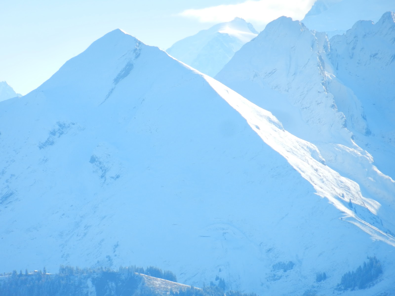
Peaks all around.

Testimony to the not too intrusive grooming at La Clusaz.

View of the Mont Blanc from Col de Balme.

Pointe Percée, the highest peak in the Aravis at 9,021.

Mont Blanc panorama.

La Tournette in the clouds.

The pass in the middle is the Col de Balme.

Sunday, November 18, 2012

First ski of the 2012/2013 season!


Yesterday was a very special day and there's only one of those a year: The first ski of the season! I went out with a friend to Tignes, a resort which is linked to Val d’Isere, and comes with some nice stats:

Number of lifts:       97
Tot. length of runs: 188 miles
Highest lift:              11,366 feet

Tignes’ most compelling feature may be its glacier which allows for year round skiing (except for a few “maintenance weeks” annual closure). The limitation is that this is only available on the top 1,000 feet or so of the mountain and skiing last year’s black ice provides very limited fun. Last week-end we had a fairly good storm and I was hoping that given the elevation at la Grande Motte (11,996 feet ) there would be some fun to be had with that snow one week later. Hopefully there would be enough snow , as far down as possible,  to Val Claret (6,993 feet). The objective was the top of the tram station at La Grande Motte (11,337 feet ).  We were expecting to have to carry at Val Claret and then get the skis on higher up.

We left at 6:30 am as Tignes is 2 hours away from Annecy and got there just a bit past 8:30 and started skinning at 9:00 am. To our surprise not only could we skin straight off the parking lot at Val Claret but the lifts were open! There was more and better snow than anticipated and we were in for a 4,300+ “pre-season” skin… and SKI! Once we made it to our destination at the tram station we found a fair amount of powder on an ungroomed glacier just under the summit rock: Mega bonus time! You just gotta watch out for those pesky crevasses and seracs which just makes the whole thing so much more interesting. This was just a much better ski than expected and an all around very legit ski day.

Here are the pictures (click to enlarge):

To the left La Grande Motte at 3,656m (11,996) and to the right La Grande Casse at 3,852m
(12,639). On the far right of 
La Grande Casse you can see a shoulder. There is a really cool
north  face descent that starts there at 3,685m (12,091) and goes down to the Col de la Grande
Casse at  3,093m (10,148) for a total sustained 
 2,000 feet descent with almost 1,500 of it 40-45°
steep
. The only real drawback on that objective is a 7,000'+ ski/climb up.

The rock at la Grande Motte with a ton of snow and some hefty seracs to the left.

A close-up on one of those pesky crevasses. Fun for the whole family but:
Falling est verboten...

View of the Tignes back country past the Champagny lift on the
Grande Motte glacier.

Here is my partner Regis Perret enjoying biting cold on the glacier with
Dome de Pramecou in the background.


Tuesday, November 6, 2012

Powder day at Le Grand Bornand


As we actually already are facing some avalanche risk (yes, in some parts we already have a multi-layer snow-pack) I didn't feel like going for my training hike alone at Tervelles with its well filled slopes at 45 degrees plus. So for more low angle I went to the ski slopes of Le Grand Bornand which is one of the local ski resorts. This is also the resort at which Ski Club Annecy-Semnoz (Max's ski club) has its permanent training room. I had a fair amount of snow there too (between one and 2.5 feet). As you can see we are getting that distinct winter feel now as some parts of our area are in full winter mode already. Here are the pictures (click to enlarge):
These guys are ready for one long cold winter...
Nope, none of this is man-made
You can almost see the mountain through the clouds.

Powder day anyone?

Saturday, November 3, 2012

A hard day’s work at the Plan de l’Aiguille


Went on a 4000 some feet training round from the Grepon parking lot up to the Plan de l’Aiguille as a reasonably fast paced non-stop-till-the-top kinda workout. I encountered a fair amount of snow with a cover  of up to two feet in some spots. Once up there I just took the Aiguille du Midi tram down. Here are the pictures:

View of the Aravis range from Chamonix. This is
about halfway between Annecy and Chamonix.
View of a windy Dome du Gouter from the Grepon trail. This is on the
"normal" way up to the Mont Blanc  when you're skinning up.
Plan de l'Aiguille with a fair amount of snow...
...and getting closer.
And the inevitable picture of Skadi.
Did you guys know that Skadi is the winter and snow goddess? This is what Wikipedia says: In Norse mythology, Skaði (sometimes anglicized as Skadi, Skade, or Skathi) is a jötunn [which means giant: Editors note] and goddess associated with bowhuntingskiing, winter, and mountains. Below is a Norwegian depiction of Skadi early last century.


Sunday, October 28, 2012

First skinning session of the season

We had a reasonably good storm (at least for October) starting yesterday and through the night. So this morning I went to Les Grands Montets (my French substitute for Alta in the pre-season, see 09 post) with my my skins and the gear for a real training session. When I say real, that is as opposed to dry land which obviously is merely fake training. The snow cover varied quite widely from 1/2 an inch to 1.5 feet and more. Anyways, although the conditions were heinous:

40 mph winds
Under very dark clouds
-13 Celsius
Rocks through the snow left and right

...this will still count as the first skinning for the season as I was able to skin uninterrupted from the lift base at 4,000 some feet (1,252 m) all the way to Lognan at about 6,500 feet (1,972 m ). Not the most brutal elevation gain but as bad as things were down at the base it was outright ridiculous at the lift mid-station so I attached the skis to my back pack and started the walk down. Here are the pictures (click to enlarge).
On the south side of the massif at Aiguilles Rouges, the
blue skies would peek through  every now and then.

Another view of Aiguilles Rouges.

Back to my side of things: Crossing one of mant streems.

Skadi always enjoying it whatever the conditions are...

All this snow is less than 24 hours old...

What a difference a couple of weeks can make (click here to see this same waterfall)

Friday, October 26, 2012

Base Camp Pfeifferhorn


When I started this blog a few years back I thought it was all about sharing and showing great backcountry tours in the Wasatch. It seems I was wrong. Looking back at the posts, most of them are dry land! That’s because I get all excited about the upcoming season as I train in the pre-season and in between the training sessions I still have enough time to blog. In the winter on the other hand, tours are great and wonderful and pretty long and all that skiing takes time away from blogging, as it absolutely should. So this year I am going to do things differently: I will in the fall share and show great backcountry tours from the prior year(s). Of course I am talking here about tours that never had been posted yet.
I am starting here with one of my absolute favorites in the Wasatch: Overnight tour at the Pfeifferhorn. My buddy Mike Florence and I had done our fair share of annual pilgrimages to the Pfeifferhorn because it is such an aesthetic area and summit in addition to having unlimited exceptionally good skiing. One day early in the season my Mike and I decided that this time around we needed more time on site and so we would camp right there and wake up in paradise! We decided to camp in Maybird gulch on top of a treed knoll that we had identified as a potentially good, safe and protected base camp. After going through route definition, equipment lists etc, we left in the am on Thursday, April 3rd of 2008 with about 60 Lbs. on our backs.

Trail head: White Pine parking lot (elevation 7,650 feet). This is about 5 1/2 miles up Little Cottonwood Canyon from the Y-Junction and 3/4 mile below Snowbird Ski Resort on the right hand sides of the road. Watch out it’s easy to miss!

Summit: 11,326 feet

Equipment: Skis, ski-crampons, crampons & Ice Axe (and of course the ever present Whippet).

The tour: We started at a comfortable 7 am knowing we would not be too pressed for time on the mountain. From the White Pine parking lot we skied down to the bridge crossing the creek and then followed the obvious trail to the right. We very early left White Pine Canyon, and crossed over into Red Pine Gulch at about 8,000 feet or so. Here we decided to not follow the regular summer route up past Red Pine Lake but instead continue west and cross into Maybird Gulch at about 8,700 feet and from there proceed to the treed knoll at about 10,700 feet to establish camp. We were done at about 11 am and had the rest of the day to explore and ski. This was a fairly stormy day with some snow and a lot of wind particularity on the ridge lines  We skinned up to the ridge line between Maybird and Red Pine and skied that, then across Maybird (heading West) to the Obelisk and skied back from there to camp as the weather was not improving. Luckily for us everything calmed completely down by the evening and by the time we were cooking the wind was gone and the skies were blue! We woke up in the morning to the same spectacular conditions, skinned up towards the Pfeiff as far is we could and then continued on crampons to the top. Here are the pictures of the tour (click to enlarge).


Starting the long heavy slog...

Getting up to the Maybird/Red Pine ridge line after having set up camp.

Mike on top of the ridge line in the storm (this is one guy that knows how to suffer in silence).

Things to come...
Across and over to the other ridge line (Maybird/Hogum) and here is Mike
at  the obelisk.  The top of the Pfeifferhorn  is  behind in the clouds. 
...and I was there too...
Back to camp in the kitchen.
Mike presiding over "base camp".


Next morning is a glorious one indeed with this immediate access to the Pfeifferhorn.
When the skins won't do it anymore, crampon up...
...and up...


Mike on top of the Pfeiff and the world...
 

View into Hogum Fork
We are gnats in the land of giants... (click to enlarge) 
Tasty lines off the ridge to the Pfeiff
Magic surroundings, majestic peaks, unlimited skiing and friends: The meaning of life!
A last look behind before it's back to camp...


Thursday, October 18, 2012

More snow!

On October 16th i.e. this last Tuesday we yet again found snow, this time at 1,400 m (4,400 feet) at Tervelles (about a 20 min. drive from home) and a lot more than last time (see: 1st Snow!). All the distant mountain shots are of the range of the Aravis, here are the pictures (click to enlarge):


And some animal life, the Chamois so characteristic of the alps: