Sunday, November 10, 2019

Wasatch - Murdock Peak and Surrounding Ski terrain

Today I went to Murdock Peak to check out the snow situation on those slopes as well as North Bowl and surrounding areas. I found a bit more snow than expected. At the bottom of North Bowl and Todd's Bowls, there was about a foot - foot and a half on the north-facing. On the South Facing, on the other hand, mostly on or about zero snow. The "base" we now have on the north-facing is facetted and promises a long presence of the feared Wasatch deep-buried instability for months to come. In any case, here are a few pictures (click to enlarge):
Jupiter's West Face and, to the left, East Face needs a fair amount of
 more snow before being of any sort of use. 

Little Water Peak in Mill Creek is looking like it's on its way.

Cardiac Bowl is pretty well filled in as well as the Cardiac Shutes.

North Bowl holds about a foot - foot and a half in the
shaded areas. Below is the North Bowl ski-out.


Loki in the foreground and Canyons Resort's Upper Boa to the left...

...and Lower Boa.

Friday, November 8, 2019

Skiing the Timpanogos Snowfield

A couple of weeks ago I had a decent ski day under pretty horrendous conditions. I got myself to the Aspen Grove trailhead (for above Sundance and started working my way up with skis and ski boots on my pack (for directions click here). Temperatures were in the low teens when I started walking at 7am and it was snowing a fair amount. The forecast said it would end at about 10 - 11am, so I figured by the time I actually ski I would have a shot at some visibility and views. It is not the first time I do this but probably the gnarliest yet in terms of conditions. The higher I got the, less visibility and by the time I got off the mountain at a little before 4pm, although it had subsided a lot, it was still snowing. The pictures were not too many nor too great but here goes (click to enlarge):
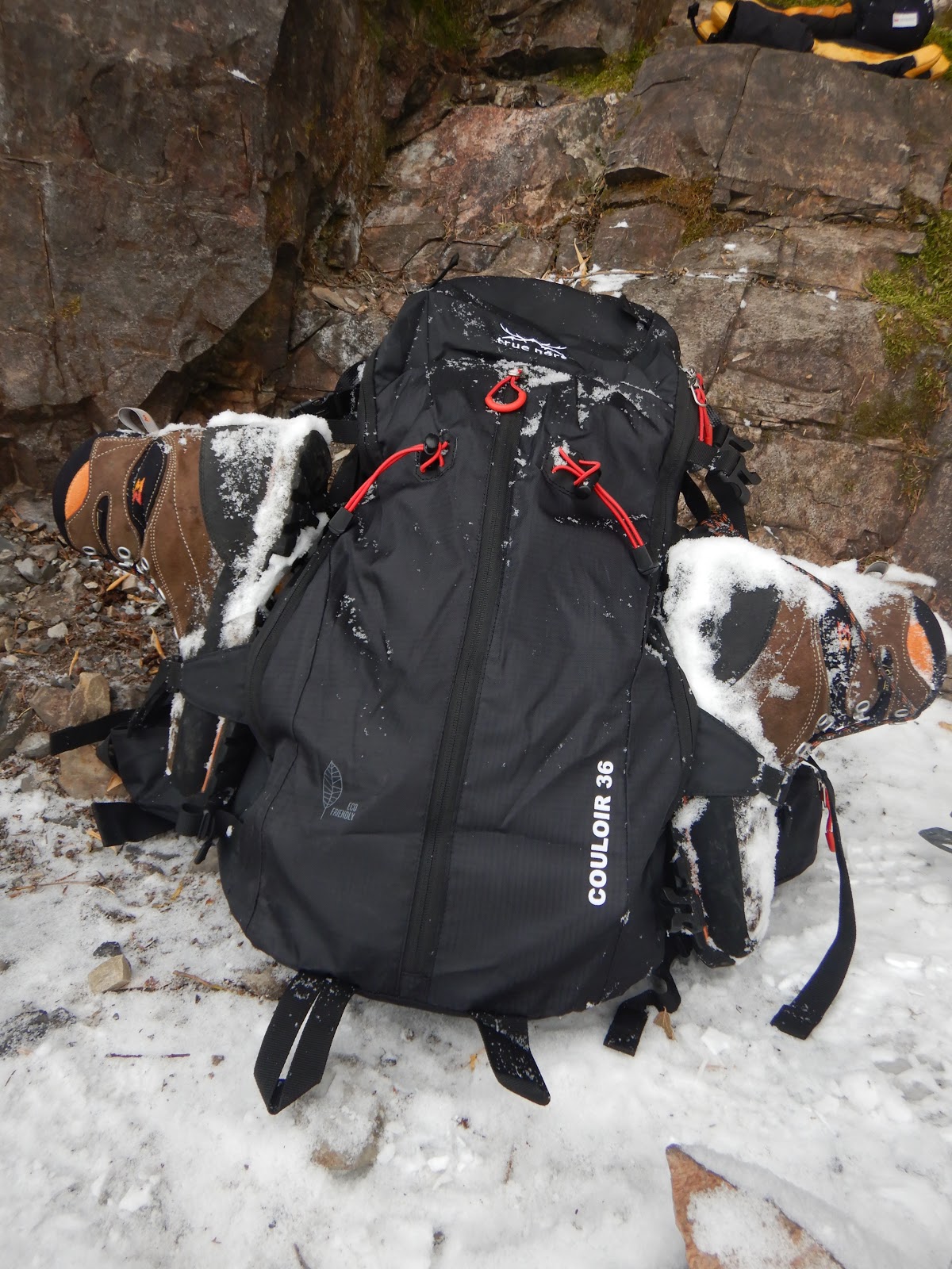
What the load looks like for the first three hours or so.

Nothing like a rock shelter for this mega transition involving first getting
out of the hiking boots, into the ski boots, and only then are we back into
the regular transition effort....


When switching from hiking to skinning, the hiking
boots replace the ski boots on the pack. Here the hiking
boots are strapped into the compression straps.

Up here its winter on Timp and Loki is loving it!
A short break in the snow gave this opportunity for a shot at the cabin.

On the way back down: One the waterfalls...

...and another one just below.


This is a testament to why one should tread on Timpanogos in winter
only with the utmost respect (this is less than 30 min from the trailhead).


These pictures were taken a few years back on a beautiful September day. This was probably my most pleasant outing to Timpanogos of them all.

Booting up...

...skiing down and be lucky enough to stumble into a pro photographer
 on the way up. He took both these shots.

Thursday, October 24, 2019

The Wasatch Snow Today

For the season there is a fair amount of snow in the Wasatch. The downside to that is that this is probably the future deep buried layer of facets that in a couple of month will give us all sorts of instabilities. It is still darn nice to look at so here are some pictures I took this morning (click to enlarge):
Cardiff Fork in Big Cottonwood Canyon with Kessler Peak (10,403') to the far
 left. If you enlarge you can see slides in Cardiac Bowl and ridge.

Gobbler's Knob (10,246') to the left and Wilson Peak (9,950') and chutes
to the right and Gobblers Knob (10,246') to the left.

To the right Murdock Peak (9,602') with Todd's Bowl under it
and to the left North Bowl.

Tuesday, October 22, 2019

Touring Deer Valley's Empire Express

Another "pre-season" ski tour today. The snow wasn't as good as it was Sunday. Today the temps were up and the weather a bit less intense. The flipside is that the snow was wet, heavy, and not as fun as it was in Sunday's teen temps. In any case, it was a nice little tour and here are a couple of pictures (click to enlarge):

Jupiter is getting a sense of foreboding from the skies...
It got a fair amount of snow for October though.

Clayton Peak (10,720') to the left and 10,420' to the right.

Monday, October 21, 2019

NOAA Winter Weather Forecast

A couple of days ago the NOAA its 2019/2020 Winter Outlook. This one covers December 2019 to  February 2020. The next installment is due on November 4, 2019.

For the Intermountain West, the forecast says higher than normal temperatures but normal levels of precipitation. To see the entire forecast click here.

Below is the precipitation probability map, we are in the white i.e. normal, for the Wasatch that's not bad considering the high level of snowfall we normally get on an average winter.


Click the below picture for a great explainer video.

NOAA Forecast Summary Video - This screenshot shows the temperature trend relevant to the Intermountain West.


Sunday, October 20, 2019

First Ski of the 2019/2020 Season

So, after yesterday's post "Winter begins in the Wasatch" we went from an encouraging sprinkle of snow to skiable in a couple of days! With temperatures in the high teens, and howling winds there sure was a bit of an Arctic feel on the outing and there is no question it felt like a full-on winter day. Although the skiing was not outstanding, it was still skiing and that snow was kind of fast. In any case, under the stipulation that any skiing is better than no skiing, this was an amazing tour!
Here are a few pictures (click to enlarge):

It is pretty white out there.

The winds they were howling... This picture of McConkey's is taken from the
porch of the ski patrol hut - the only windfree spot today!

Loki having a good day,

The sun came out just in time for us to get back to the parking lot.

Rock skis and a yet another shameless true north plug.

Friday, October 18, 2019

Winter begins in the Wasatch

Time to get the stoke on! Here a couple of pictures taken of a sprinkle of snow at 7,500 - 8,000 feet in the Wasatch this morning. It should get better over the week-end, see the last picture or more on that. Click to enlarge:

The summit here is at 8,100'.

Where the sun hits it's about 7,500'.
Today's Park City forecast at 9,400' for the weekend. By Sunday
evening the expected accumulated snowfall is a total of 8" - 13"