Friday, September 29, 2017

First ski of the 17/18 season

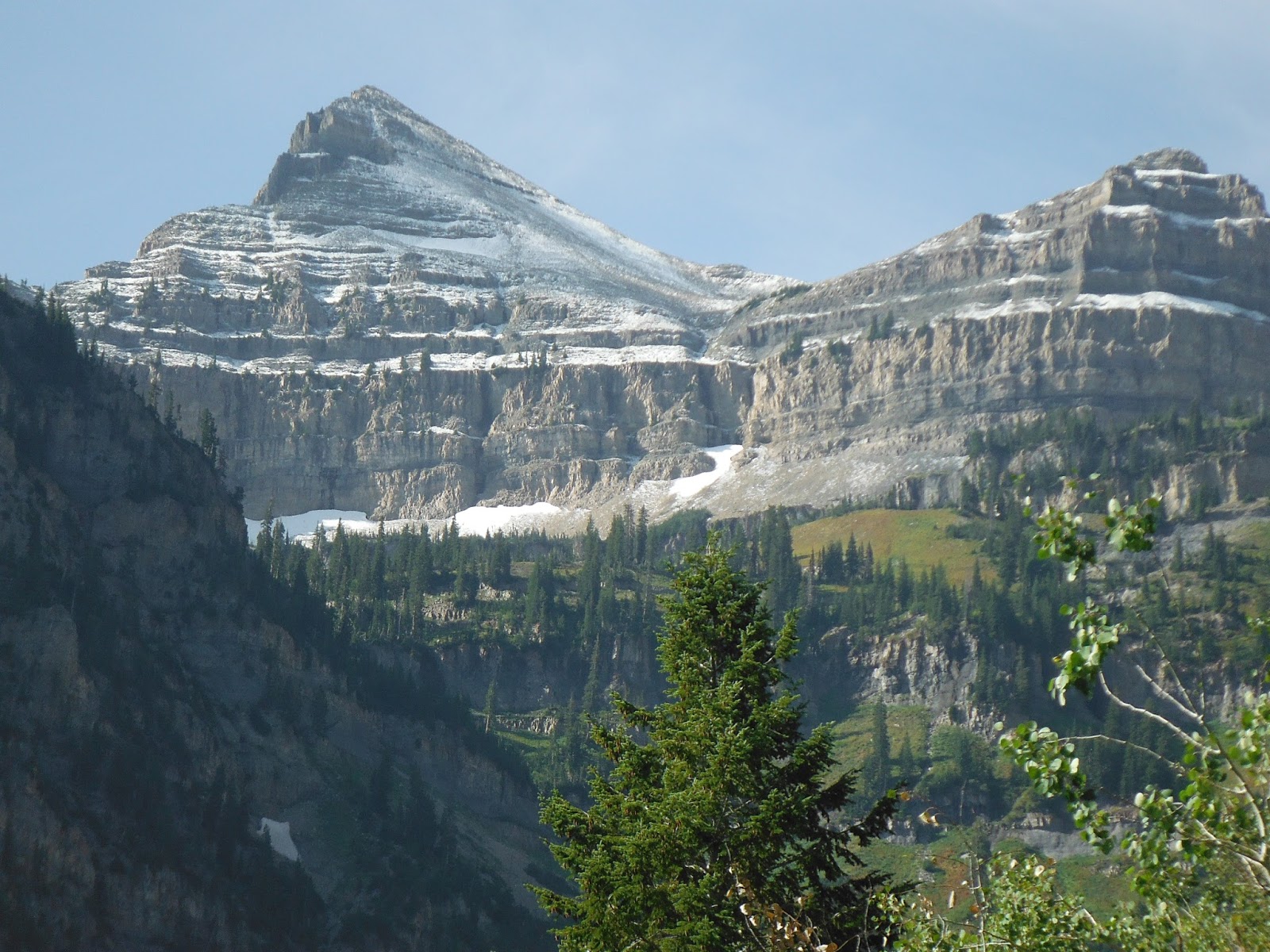
Went back to the Timpanogos snowfield and it held quite a bit more snow than a couple of weeks ago. That snowfield is how I get September skiing in in Utah but you gotta want it pretty bad! One, the skiing is good, not great but good. Two, you have to be your own pack mule carrying a bit over 40 lbs for 3,500 feet and some before you start skinning. Then you have to gain another 1,000 feet before you get your first turn in! However, if you’re into that kind of thing, this is the place for you. I was solo so no pictures of me skiing but you do get to see me at the Emerald Lake Shelter (base of the snowfield) with my impossibly heavy pack.

I was planning on a few laps but I only got one run in before Loki (my dog) got hurt with a pretty impressive gash on his left forward leg (see picture below). Now I had to book it down asap to make it to the vet before they close for the day. I had to drop those 3,500 feet and six miles half-running (best I could do) with that heinous load on my back. I made it to the vet in Park City with about 6 min. to spare. Thankfully White Pine Veterinary Clinic puts the dog first so they were willing to do the overtime for Loki.

Here are yesterday's pictures:
Aspen Grove parking lot when I
was still excited about the load.

Hidden Lakes Cirque is now mostly white.

Yours truly not a little self-satisfied and getting that load to the
Emerald Lake shelter. Foto credit: Wade from Mississippi.

The snowfield has improved a lot in the last two weeks...

...especially the higher part to the Saddle.

Loki standing right in the way.
That's before he got hurt (see below).

Although this was my first ski I did not have to break trail.

This is after the first lap. Loki "caught an edge" and
the "rescue mission" was in full swing.


The "before" pictures: Same place - 11 years ago

These pictures are from September 30, 2006, when I went up with my son, Nico (he was just 14 at the time):


Nico ready for a bright and early start!

Pretty good cover in the higher cirque.

Nico and I toiling up the interminable snowfield.
That day was a lot sunnier than yesterday.

Finally on top with a fairly long ski ahead of us...

...and finally the reward!

Sunday, September 17, 2017

The Mt Timpanogos Snowfield is Back!

This used to be presented as a “permanent” snowfield in reaction to more ambitious word choices such as “the Timpanogos glacier” that you can find here and there in the literature (not naming any names here…). That snowfield was proven un-permanent when it vanished some years ago, and up until and including last summer, there wasn’t a flake of snow on that field, only desolate rock.

Having been up that mountain a lot of times, I have noticed, in seasons past, that even one good storm can produce surprising amounts of snow and a reasonably good snow cover. Considering further that last winter produced a copious amount of snow, and it just snowed up there yesterday afternoon and parts of the night, I figured a visual inspection may be in order. Although quite curious, I was not overly optimistic thinking it would take quite a few seasons to rebuild a thing like that. Well, I got to find out that that snowfield is very substantially back! It is close to the shape it was in when I last skied it. One or two more decent seasons and this thing may start feeling a lot more permanent again… While waiting for that, the short term is very encouraging as can be seen in this NOAA forecast for this week at 10,300’ (bottom of the snowfield):
The graphics for this forecast only goes till Thursday night. After that,
the text version says "Chance of snow" from Friday till Sunday included.

The snowfield, when full, starts by the Emerald Lake Shelter at about 10,300’. It is encased by a triangular cirque with the following boundaries: at its west the Mt Timpanogos summit (11,748’), at its east the Mt Timpanogos shoulder (11,161’), and at its southernmost point the saddle where you start skiing (11,300’). The map below shows the Saddle and the Shoulder, materialized by the dashed line is the best ski line i.e. the one with the least double fall line.

…and here are today’s pictures (click to enlarge):
First impressions are everything! This is the view that opens up
about an hour into the hike up.

Same view but including Primrose Cirque which
holds some of its own snowfields.

"The Timp Glacier" in all its splendor and at about 90% of the best
I ever saw it.

Closing in on the upper part of the snowfield. The very top
 is why it's not at 100% as the first 100 or so feet need more snow.

A couple of guys came up from the Timponeke trail with their skis. This one
is booting up with skis on the backpack.

Partial view of Emerald Lake as seen from the shelter.

Tuesday, September 12, 2017

First snow on the forecast!

This week we get our first snow forecast of the year. On September 12 that is not so shabby. This must obviously mean an epic winter coming our way - without a shadow of any doubt at all!
This is the Park City forecast at 9,400' elevation...

...and this is the Alta forecast at 9,400' elevation.

Friday, August 4, 2017

Park City Summer Picture of 2017

After a mega winter (actually normal but after all the puny years, normal feels mega) the hills are saturated with water. On top of that most of last week was rainy so when Mike and I went up hiking last weekend there was growth everywhere and Mike got the shot of the year.

Here is the picture worth a 1000 x 1000 words:

Spectacular flower garden below Pinecone Ridge. In the immediate background is part of Scotts Bowl and in the
distance Mt Tuscarora and Mt Wolverine both on the divide between Big and Little Cottonwood Canyons.
Photo courtesy of Mike Florence.

Thursday, January 26, 2017

Telluride

This is one impressive mountain! I expected something pretty good of this place I have heard so much about. However this being a resort I did temper my expectations. Well those were easily beaten. This place has something for everyone and a heck of a lot for BC skiers and generally advanced skiers. Groomers are kept to a minimum, some of them are not even groomed the day after a storm, only a couple of days later. These guys know how to not waste the powder… In many ways this resort, especially in the higher terrain, reminds me of Les Grands Montets in the Chamonix valley where they only groom one way down from top to bottom and leave all the rest untouched.

The valley floor here in Telluride is at 8,725 (the Coonskins lift) and the highest lift will drop you off at 12,570 feet (Revelation). That’s not all though, if you are ready to hike there are another 800 feet to gain by boot packing to the summit of Palmyra Peak at 13,320 feet. Now you are up to a total vertical of 4,500 feet. Here's a cool fact about this side contry, from the top of Palmyra Peak to the point at which you get back into lift served territory (Prospector Express base) you have dropped 2,500 feet of never groomed terrain.

There is a bunch of good lift-served skiing but for more interesting lines get out the gate beyond the lift served skiing. One huge attraction is that even though you are beyond the lift served terrain as long as you stay inbounds its all avalanche controlled. You also have gates to get out of bounds into Bear Creek which is absolutely monumental. One attraction there is the San Joaquin couloir.

This place is also full of cool history and here is one example of that: Butch Cassidy got started on his new career here. He robbed his first bank, in Telluride and took off with $24,000 from the San Miguel Valley Bank on main street (West Colorado Ave). He got away with it, the posse never caught up.

I owe a debt of gratitude to Jack, a coach with the Telluride Ski Club that I stumbled into on my very first venture out. He showed me some really good ropes and the optimal order for some of these lines that enabled me to grab bonus lines all the way down. Thanks Jack!

Here are some pictures taken today (click to enlarge):

View up towards Palmyra Peak (13,320) although
the summit is hidden in the clouds.

Mountain Quail (left) and Dihedral Face (rigth) both in
the Black Iron Bowl area.

Close up of Mountain Quail

Mountain Quail in the distance,

Dihedral Face

Looking down Dihedral Face

Looking down  Dihedral and beyond.

View of Review.

Looking down Review

Jack who showed me around.


Sunday, January 15, 2017

Iron Mountain Powder

You know this is a great winter when you start accumulating "best evers" on any given hill. Last week it was best ski yet off of McConkeys (in resort) today it was Iron Mountain's turn. This is a very basic local Park City tour that starts by a 2,000' elev. gain to the summit of Iron Mountain then however many laps you feel like in its bowls. Today was my best ever ski in these bowls on very light yet slightly dense and so really fast powder.

Here are the pictures (click to enlarge):

Starting the skin  up to Iron Mountain at level with the clouds.
Picture taken on the lower Pinecone ridgline.

All the surface hoar you can eat! Maybe this is the drama in store for
our next storm system that seems to be due to start on Wednesday.

First (from the top) Iron Mtn bowl, best skied close to or
 in the trees to the upper left of the picture.

Second (from the top) Iron Mtn bowl.

West Monitor bowl practically skied out...

From the summit of Iron Moutain a view of Lewis Peak in the distance
and, in the foreground, access to the Iron Mtn bowls.

Loki barely keeping head above snow in one of the bowls.


Friday, January 6, 2017

Ski in - Ski out in Old Town Park City

Today I got to ski back all the way home from the resort. When the winter is normal (not like the last five seasons) a lot of Old Town Park City homes become ski in - ski out properties. Lucky for me: 1) I live in higher Old Town Park City, and 2) this is a normal Wasatch winter. If I ski out high from the Quittin Time slope and bank a hard right high up on it, I end up high on King road. From there all I have to do is ski down the road (there are always snow banks on each side) then take a left turn (see first picture below) and end up on the other side of the road from my drive way.

Here are the pictures (click to enlarge):

Sharp left turn down to lower King rd and continue skiing till
under the large evergreen (picture taken from my front porch).

Looking up Treasure Hill, the hill that the Park City ski resort is on. This is
the "backside" from the resort's perspective. If you look up the hill you see...

...a guy skinning up (mega zoom), would he continue to the top he'd end up
at the top station of the Park City resort Payday lift.