Thursday, January 10, 2013

Conditionnement physique au Grands Montets

Hier j’ai voulu tester ma capacité à faire une course à 2000m de dénivelée. Etant seul je suis partis le faire en station et avec ma fascination pour le massif du Mt Blanc je suis allé aux Grands Montets. En partant du parking et allant jusqu’au sommet de l’aiguille il y a un dénivelé de 2043m pour être précis. A la redescente je suis redescendu 100m sur mon altimètre pour les remonter histoire de battre mon record personnel de dénivelé  en pieds c.à.d. 7000 pieds. Une journée bien remplie mais étant en station les photos que j’ai prises sont surtout des aiguilles et monts environnants plutôt que des pistes balisées.

Carte topo : 3630OT (Chamonix)
Orientation : N
Altitude de départ : 1252
Altitude Aiguille des Montets : 3195
Dénivelé : 2043 m

Accès voiture:
Traverser Chamonix, continuer vers Argentière (env. 8 km) puis au rond-point juste avant Argentière  prenez à droite pour le parking des Grands Montets.

Accès pistes:
Les pistes de « Pierre a RIC » jusqu’à la Croix de Lognan (1972m) puis la pistes des Pylônes jusqu’au sommet du TS de la Herse et ensuite  jusqu’à la buvette des Grands Montets. Y laisser les skis et faire le reste à pieds.

Voici les photos (cliquer pour aggrandir) :
Aiguilles Rouges et le Haut Giffre en arrière plan
Aiguille Verte (4212m) vue de l'Aiguille des Grands Montets


Les Drus vus de « derrière »…
Le Mont Dolent (3823m) et le la partie haute du glacier d'Argentière 
Aiguille d'Argentière (3901m) 
Aiguille d'Argentière, glacier  du Chardonnet
Aiguille d'Argentière, glacier  du Milieu
"Entrée" du glacier du milieu
Aiguille Verte
Seracs du glacier d'Argentière

Friday, January 4, 2013

Refuge de Gramusset 2164m

POUR LA VERSION FRANCAISE CLIQUER ICI


From the refuge de Gramusset (or Refuge de La Pointe Percée) you will be within day-touring reach of La Pointe Percée, Col des Verts and La Pointe de la Carmelite.
La Pointe Percée is the culminating point of the Aravis range at 2750m.
The Col des Verts (2595m) is between la Pointe des Verts and la Pointe Percée and is the most fun ski of the three.
The Pointe de la Carmelite is the unofficial name given to the 2477m point just north of Pointe Percée.
The refuge is a hut of the French Alpine Club (CAF Annecy section) and has a small section of it that although not manned, is open off season i.e. winter as far as we are concerned (how winter could be “off-season is beyond me). There is a large table, 2 benches, some chairs, a very efficient stove, some cooking utensils and a small kitchen with 2 gas burners.
There is a wood supply and a few axes and saws. The is also a series of bunk beds with mattresses, pillows and blankets for about 16 people and dry toilets (who could ask for anything more!).
The nightly fee is € 8 (leave cash or check in the box) including wood and gas. The room is well equipped, has a great ambiance and is very pleasant in the most spartan mountainy kinda way.

Topo map: 3430ET (French IGN reference)
Dominating aspect: NW
Starting elevation: 1160
Hut elevation: 2164
Elevation gain to the hut: 1004 m to this add:

585 m for la Pointe Percée
313 m for la Pointe de la Carmélite
431 m for le Col des Verts

Access by car:
Drive through the village of the Grand Bornand, leave the church on your right, pass the lift parkings of and then continue on departmental road D4E, pass Le Bouchet and then the Nordic tracks. The road stops at "Les Troncs" (4-5 chalets) and you must park on the roadside just before them and not on the parking lot reserved for them.

Trail access:
Walk through "Les Troncs" and where the road ends the trail starts.

Here are some pictures of the hike from Les Troncs to the Refuge Gramusset taken yesterday:

Park just before the chalets of "Les Troncs"

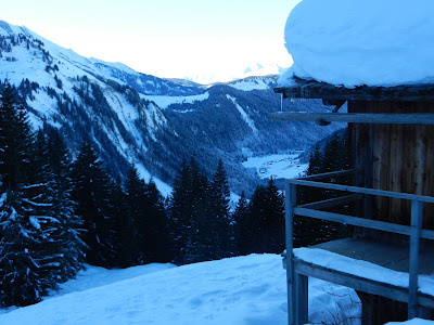
Beginning of the hike through the trees looking back on the valley.

About an hour some into the hike a "natural"resting place.

First sun...

The summit of La Tournette

Just for the beauty of it...

...this one too

Approaching the hut with La Pointe Percee to the left and La Pointe Verte to the right.
Valley floor below and La Tournette in the distance.
Partial view of the much larger head-wall under the Col des Verts.
Well snowed in entrance of the Gramusset hut

The sleeping quarters...


Refuge de Gramusset 2164m

A partir du refuge de Gramusset (ou Refuge de la Pointe Percée) vous serez à portée (en course à la journée) de la Pointe Percée, du Col des Verts ou encore de la Pointe de la Carmélite.

   - La Pointe Percée se passe d’introduction étant le point culminant des Aravis à 2750m.
   - Le col des Verts (2595m) se situe entre la Pointe Percée et La Pointe des Verts et présente peut être le plus d’intérêt sur les trois du point de vue du skieur.
   - La pointe de la Carmélite est l’appellation non-officielle du point 2477m juste au nord de la Pointe Percée.

Le Refuge est un chalet du Club Alpin Français (CAF-Annecy) et dispose d'un petit local qui reste ouvert hors période de gardiennage c.à.d. l’hiver. Il y a une grande table, 2 bancs, quelques chaises, un poêle très efficace, quelques ustensiles de cuisine et une petite cuisine avec 2 feux au gaz.
Il y a quelques haches et scies et une réserve de bois. Le couchage se fait sur une série de lits superposés avec matelas, oreillers et couvertures pour environ 16 personnes et il y a des toilettes sèches.
Il y une redevance de 8€ (à laisser dans une boite à cet effet) pour la nuitée, le bois et le gaz hors période de gardiennage. La pièce est bien équipée, dégage une bonne ambiance et est très agréable dans la plus grande simplicité montagnarde.

Carte topo : 3430ET
Orientation : NW
Altitude de départ : 1160
Altitude refuge : 2164
Dénivelé : 1004 m, à cela ajouter :

+585m pour la Pointe Percée
+431m pour le col des Verts
+313m pour la pointe de la Carmélite

Accès voiture:
Traverser le Grand Bornand, laisser l’église à votre droite, passer les parkings des télécabines de Rosay et de la Joyère puis s’engager sur la D4E tu passeras Le Bouchet puis les pistes et le centre nordique. La route s’arrête aux « Troncs » (4 – 5 chalets) et il faut s’arrêter au bord de la route juste avant ceux-ci et non pas sur leur parking qui leur est réservé.

Accès trace:
Passer les chalets des Troncs et là où la route s’arrête et vous verrez le début de la trace.

Voici des photos du trajet des Troncs au Refuge de Gramusset prises hier (pour agrandir cliquer sur la photo) :

Se garer au bord de la route juste avant les Troncs (D4E)...

Vue du début de la montée par la forêt. Au début de la trace deux
options : Montée direct bien pentue (prendre à droite) soit montée
par la forêt  (toujours bien pentu) ce que nous avons choisis. 

Apres une env. une heure de « route » replat et pause naturelle
près d’un chalet bien enneigé.

Jeremy sur le toit...
Patrick dans l'effort...
...puis Isabelle...
et Laurent, Pierre Le-Trouveur-de-Ski  (merci Pierre!) et Jeremy.

Le soleil se pointe...

Just parceque c'est si beau...

A l'approche du refuge vue de la Pointe Percée (gauche) et de La Pointe des Verts  (droite)
La Tournette

La vallée au fonds et la Tournette au loin

A partir du refuge, vue partielle de la pente sous le col des Verts

Entrée bien  enneigée du Gramusset de la section non gardée.


Tuesday, January 1, 2013

Orienting yourself on the Plan de la Fenêtre

The Plan de la Fenêtre is situated in the Beaufortain massif where it abuts the Mont-Blanc massif. This area is a phenomenal playground that in “pure” backcountry skiing is reached from the Notre Dame de la Gorge trailhead (after the Contamines village and resort) at about 1200m but can also be accessed as side-country from the Contamines lift system. The mini sub-range shown below starts from the col de la Fenêtre and ends at the col du Bonhomme with a bunch of good ski lines that are mostly east facing. Here are the pictures (click to enlarge):

Petite orientation à partir du Plan de la Fenêtre

Le Plan de la Fenêtre est situé dans le Beaufortain là où il rencontre le massif du Mont Blanc. En randonnée « pure » le départ se fait de Notre Dame de la Gorge (en hors-pistes tout ceci est accessible à partir des téléphériques des Contamines). Le petit bout de chainon illustré ci-dessous part du col de la Fenêtre jusqu’au col du Bonhomme et les pentes skiables sont d’orientation à dominante Est. Pour agrandir cliquer sur les photos :

Seen from/Vu de: Plan de la Fenêtre

Seen from/Vu de: GR tour du Mont Blanc


Sunday, December 30, 2012

Col de la Cicle 2377

Yesterday, I went out on my second outing with the Chamonix chapter of the Club Alpin Français (CAF). First a word on this venerable institution:  The Chamonix chapter of the CAF was established in 1902 by MD Michel Payot. Since those days it has seen a handful of venerable presidents and the current one is Monsieur Roland Ravanel. Roland was born in 1938 in Chamonix, a man with a passion for the mountain and an avid skier; he became a ski instructor and mountain guide. He belongs to the prestigious “Compagnie des Guides de Chamonix” (where he has held leadership positions) and the ski school of Argentière, his childhood village. He is still skiing and guiding. As a schoolmaster for over 25 years in Chamonix, he has introduced nearly a thousand kids to skiing and mountain climbing. On top of all that he is the nicest guy you’ll ever meet.
The tour took us from Notre Dame de la Gorge (about 3,800 feet) where the trail head is to Col de la Cicle. It turned up to be pretty long slog as in miles travelled to Col de la Cicle which is an east facing slope that starts at about 35 degrees angle. The weather was glorious, the avalanche risk evaluated at Medium (level 3) but mostly for south facing slopes and we had about a foot of freshies on a fairly solid snow pack 10 feet deep on top. We had an opportunity to ski the steeper and longer Col des Chasseurs but some of us (including me) voted against not wanting to tickle the great white one too much (I was however a bit jealous and felt some regret when I saw a couple of guys get away with it a couple of hours later…).  
Here are the pictures (click to enlarge):
A bit less than an hour into the hike the ridge line we are looking for appears.
This picture shows from left to right ("Col" stands for pass): Coll du Bonhomme,
Aiguille de la Pennaz and Col des Chasseurs.

A view of Col des Chasseurs that gives a sense of how tasty this thing ca be...
Col de la Cicle

Col de la Cicle: The slope

Col de la Cicle: The "backside" with

Unlimited possibilities, see the village of Contamines down in the valley where the hike starts.

From left to right: Aiguille de Bionnassay 4052 m (13,295), Dome du Miage
 3670 m (12,042), and Mont Blanc 4810m (15,783)

Close up of the Mt Blanc summit

Close up of the snowfield of the Dome du Miage that under good
conditions is the start of a  ski run dropping 9,000 feet...

On the way out: Sunset in the mountains...

Monday, December 24, 2012

Mont Joly (Beaufortain)


Saturday I had my first outing with the Chamonix chapter of the Club Alpin Français (CAF).  The weather window was limited to the morning after which a storm was coming in the PM.  We went to Mt Joly which was not the first choice but a compromise to the avalanche conditions. Mt Joly is just south of the Mt Blanc Massif. Although not too remarkable an objective t is one of those features you see prominently from the high way driving towards Chamonix and I like to ski those if nothing else to kill that curiosity that comes with checking out all skiable lines from the road… Although the conditions wern't ideal and the snow a bit sun affected, the skiing ended up being surprisingly good.

Here are the pictures (click to enlarge):

On the way up; view of the Mt Blanc massif ridge line. The pyramidal peak seen in the middle of the
picture is  the Aiguille de Bionnassay 4052m (13,292 feet). The pass to the left of it is the
Col de Miage and further to the left the two Dones de Miage.

Close up of the Aiguille de Bionnassay.


The objective of the day: Mont Joly

What it looks like from the road on a blue bird day...