Tuesday, October 22, 2019

Touring Deer Valley's Empire Express

Another "pre-season" ski tour today. The snow wasn't as good as it was Sunday. Today the temps were up and the weather a bit less intense. The flipside is that the snow was wet, heavy, and not as fun as it was in Sunday's teen temps. In any case, it was a nice little tour and here are a couple of pictures (click to enlarge):

Jupiter is getting a sense of foreboding from the skies...
It got a fair amount of snow for October though.

Clayton Peak (10,720') to the left and 10,420' to the right.

Monday, October 21, 2019

NOAA Winter Weather Forecast

A couple of days ago the NOAA its 2019/2020 Winter Outlook. This one covers December 2019 to  February 2020. The next installment is due on November 4, 2019.

For the Intermountain West, the forecast says higher than normal temperatures but normal levels of precipitation. To see the entire forecast click here.

Below is the precipitation probability map, we are in the white i.e. normal, for the Wasatch that's not bad considering the high level of snowfall we normally get on an average winter.


Click the below picture for a great explainer video.

NOAA Forecast Summary Video - This screenshot shows the temperature trend relevant to the Intermountain West.


Sunday, October 20, 2019

First Ski of the 2019/2020 Season

So, after yesterday's post "Winter begins in the Wasatch" we went from an encouraging sprinkle of snow to skiable in a couple of days! With temperatures in the high teens, and howling winds there sure was a bit of an Arctic feel on the outing and there is no question it felt like a full-on winter day. Although the skiing was not outstanding, it was still skiing and that snow was kind of fast. In any case, under the stipulation that any skiing is better than no skiing, this was an amazing tour!
Here are a few pictures (click to enlarge):

It is pretty white out there.

The winds they were howling... This picture of McConkey's is taken from the
porch of the ski patrol hut - the only windfree spot today!

Loki having a good day,

The sun came out just in time for us to get back to the parking lot.

Rock skis and a yet another shameless true north plug.

Friday, October 18, 2019

Winter begins in the Wasatch

Time to get the stoke on! Here a couple of pictures taken of a sprinkle of snow at 7,500 - 8,000 feet in the Wasatch this morning. It should get better over the week-end, see the last picture or more on that. Click to enlarge:

The summit here is at 8,100'.

Where the sun hits it's about 7,500'.
Today's Park City forecast at 9,400' for the weekend. By Sunday
evening the expected accumulated snowfall is a total of 8" - 13" 

Wednesday, October 16, 2019

Words of wisdom...

As the season should finally be around the corner I felt it was a good time to dwell on the meaning of life and skiing and other eternal truths. Since a picture is worth a thousand words, here are a couple of thousand words of wisdom:


Sunday, October 13, 2019

Fall in the Wasatch

Fall is a great time to be out in the Wasatch with a bunch of benefits:

1. Given the colors, it's even more beautiful out there than usual.
2. The air is clear and it's not hot so if you are working out you can really go after it in some comfort.
3. It's not yet the ski season so solitude is still possible - the downside of that is of course that "It's not yet the ski season"...

Here are a couple of pictures plus a plug for my backpack (click to enlarge):

Fall colors wit on the horizon Murdock Peak (the highest one) and to its
immediate left Todd's Bowl and further to the left (past the trees) North Bowl.

View into Lambs Canyon.

The one and only true nðrŧ (nope, it’s not a typo, see here) COULOIR 22.


Saturday, September 28, 2019

NORDKAPP! 71° 10’ 21”

I left Karesuando, which is in Sweden on the border to Finland, on September 15 and crossed the bridge crossing the Muonio River which materializes the natural border with Finland. No border controls here, cross the bridge and you're in Finland! This is the very northernmost part of Finland in the municipality of Enontekiö, an important part of Finnish Lapland. This is a narrow strip of Finland so within a few hours, you get into Norway and then have to cross the entirety of the northernmost part of Finnmark (Norwegian for Lapland). Here I got to drive through Katokeino, probably the largest center of any Sámi reindeer herding district in Norway. After that, it's through Alta and on to Nordkapp.


At 71° 10’ 21” of Latitude North, Nordkapp is the northernmost spot on mainland Europe and so also the northernmost spot in Lapland. This has been really high on my bucket list for a very long time. I never got to it because you don’t just happen to “get to” Nordkapp. It is literally out of the way. 
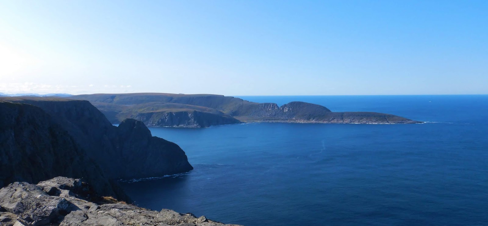
We are here in the Northernmost part of Arctic Europe, it is actually the end of the road and you are here overlooking the Barents Sea, part of the Arctic Ocean. Also known as the “end of the habitable world”, it is a place of almost incomprehensible beauty. It surely is an indescribable beauty to this author so I am not even going to try. Here are some pictures, they don’t either do the place justice but I feel the pressure to show something... (click to enlarge):


71 degrees north is as long as this goes on land...

View of Lappiljävri in Finland. The literal translation would be "Lapp Lake".

Entering Norway that lets you know that
you will be sharing the road with snowmobiles

Katokeino, the largest reindeer herding center in Norwegian Lapland.
Here on the signage, they not only add the name in Sámi, but the Sámi
version is also first, as it damn well should be everywhere in Lapland!

To the right the church of Katokeino.

A view of Alta River.

The hills just south of Alta...

...still south but very close to Alta.

Partial view of Alta Fjord - I don't have an objective
wide enough for a full view.

Reindeer herd on the tundra at Gukkesguravarre. Did you know that the
word "tundra" comes to us from the Sámi language? 

View of a river as I get close to Olderfjord...

...same river different view.

A traditional Sámi hut. The most common one was the "Lavvu" 
(similar to the tipi) but these semi-solid structures had their use too. 
Some of these would be exclusively for cooking, others for 
temporary shelter on the reindeer migration...

...a larger and more elaborate one that would serve as a shelter.

A fishing station in Porsanger Fjord. This is the land of the "Sea-Sámi".
They were Sámi that mainly lived off the sea (fishing and hunting sea
mammals) while reindeer herding was a supplement. The land Sámi
would mainly live on land mammal hunting and pastoralism with
fishing being the supplemental activity. 

A smaller Fishing station on Porsangen Fjord.

Lone reindeer on Porsangerhalvøya...

Still on Porsangerhalvøya a cow and her calf.

Closing in on the "ends of the inhabitable world"...

Getting to the end, Máhkarávju (in Northern Sami) or Magerøya
(in Norwegian). This is the northern peninsula at the end of which,
after another 5 - 6 miles, the road comes to an end at Nordkapp.

The dramatic cliffs of the north.


To the immediate East of Nordkapp.

Nordkapp overlooking the Arctic Ocean. It is materialized by the globe.