Saturday, April 27, 2013

Situating yourself at the Aiguille d'Argentière


Was up on a depressingly hot day (a couple of days ago sombody pushed the "summer switch" and skipped the spring one...) to Les Grands Montets. The skiing was average at best and the choice was between wet slushy on the south facing and ice rink solid on the north facing. Feeling less time pressure to yo-yo up and down for unrewarding skiing, I took out the time to take these pictures all from one spot:  the Aiguille d'Argentière.

These are hard times; you can practically feel the season dying out...

Here are the pictures, to see any details, click to enlarge:

Looking NE the dominating feature is the Aiguille d'Argentière which is
 surrounded by good ski objectives and/or passes into the great glaciers
 of Saleina and du Tour or to access into Italy and Switzerland.
Looking South: Mont Dolent is not only a near perfect pyramid, it has
three sides each in a different country.
Looking south: Mont Blanc. The "normal route" to the top on skis, has you
take the tram du Midi to the mid-station  then cross the Glacier des Bossons
 and spend the night at the refuge des Grands Mulets at 10,000 feet.

Wednesday, April 24, 2013

Hut to hut in the Thabor massif – Day 3/3 (April 14-2013)


For day one click here.
For day two click here.

The weather report announced really warm weather and wet snow avalanches had been pretty active yesterday in the pm so we figured we had two good reasons to get up a bit early, the second one being not missing out on the spring corn...We left the the I Re Magi hut at 7 and started skinning north up the Vallée Etroite and then west and south towards the Col du Vallon (2645m).  The trail started off pretty flat then got quite steep which allowed us to gain elevation a lot more efficiently than the two prior days. We were at the pass at about 10 and from there we had a wide open view towards Vellée de Clarée.

Below is our route with the day 3 route in yellow:


Topo map: 3535OT (French IGN reference)
Dominating direction: NE then SE
Starting elevation: 1780m
Pass elevations : 2645 (Col du Vallon)
End elevation: 1603m (Névache)

Click here for Laurent's photos and videos.

Here are some of my pictures of day 3 (click to enlarge):

Early start to beat the heat...
Looking back on the village and the hut
Looking back on Vallée Etroite with the village on the valley floor
 and Sestriere (2006 Winter olympic venue) in the distance.
Laurent working his way up
Lots of space and large features...
A break on the way up
Frank giving free reign to his exebhisionistic tendencies...
Really worth coming back for...
First sighting of the Col du Vallon
From Col du Vallon, looking down onto the "other side"
From Col du Vallon a view of the Mont Blanc in the distance (with max zoom)
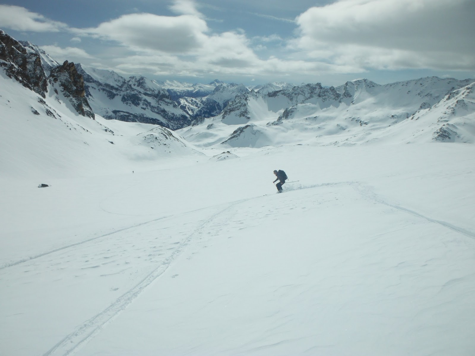
All sorts of skiable terrain...
First avalanche from the prior day, we are glad to be here early. Click to enlarge
 to see the scale against Jean Marc who is practiclty at the end of the run off. 
They have broken all the way down the valley...
...and this is where you thank someone for still being around...
From left to right: Laurent, Pierre, Jean Marc and Frank
Last stretch on skis...
...and on foot...
...and back to Névache where it all started three days ago.


Sunday, April 21, 2013

Hut to hut in the Thabor massif – Day 2/3 (April 13-2013)

For day one click here.

We left the Refuge des Drayéres at 8 and started skinning east towards the Col des Muandes (2828m).  The trail was pretty flat but also pretty long so mileage was more of a delaying factor than elevation gain. We were at the pass at about 10:30 and from there we had a wide open view towards Italy. This day we got to make up for the lack of skiing from day one.

Below is our route with the day 2 route in black (click to enlarge):


Topo map: 3535OT (French IGN reference)
Dominating direction: NE then SE
Starting elevation: 2180m
Pass elevations : 2828 (Col des Muandes)
Hut elevation: 1780m (Refugio I Re Magi)


Here are some pictures of day 2 (click to enlarge):

Jean Marc, Laurent and Frank bright and early
Wide open spaces...
Yours truly
You get enough time out there to get into the zen of the mountain
Skinning some more...
...in surroundings where you can find an infinite amount of appealing lines...
...and amazing winter landscape.
This one is here just because...
...and this one too.
At the Col des Muandes with a view into Italy.
Starting to make up for no downhill ski yesterday.
Jean Marc plying his trade...
...and Frank too
Nice Aiguille
To the left Pointe Balthazar - to the right Pointe Melchoir,
 and, as I found out later from an Italian guide: in the middle
Couloir de la  Gallina. I will have to come back for that  one.
This is where we stopped for lunch...
...for which both Jean Marc and Frank brought a bottle of Graves and some cheese...
Enough sitting around, back to work...

View into Vallée Etroite at the bottom if which we'll find the hut.
Refugio I Re Magi which translates into the three wise men. The three peaks
 dominating it to the West are: Pointe Gaspard (2808m), Melchoir (2948m)
and Balthazar (3153m).
The expedition staff...
Grand Séru at the end of the Vallée Etroite.
This is what it looks like when an avalanche runs out from Pointe Gaspard.
Entrée...
Main course of polenta and sausages... A fitting end to any ski day.