Sunday, April 21, 2013

Hut to hut in the Thabor massif – Day 2/3 (April 13-2013)

For day one click here.

We left the Refuge des Drayéres at 8 and started skinning east towards the Col des Muandes (2828m).  The trail was pretty flat but also pretty long so mileage was more of a delaying factor than elevation gain. We were at the pass at about 10:30 and from there we had a wide open view towards Italy. This day we got to make up for the lack of skiing from day one.

Below is our route with the day 2 route in black (click to enlarge):


Topo map: 3535OT (French IGN reference)
Dominating direction: NE then SE
Starting elevation: 2180m
Pass elevations : 2828 (Col des Muandes)
Hut elevation: 1780m (Refugio I Re Magi)


Here are some pictures of day 2 (click to enlarge):

Jean Marc, Laurent and Frank bright and early
Wide open spaces...
Yours truly
You get enough time out there to get into the zen of the mountain
Skinning some more...
...in surroundings where you can find an infinite amount of appealing lines...
...and amazing winter landscape.
This one is here just because...
...and this one too.
At the Col des Muandes with a view into Italy.
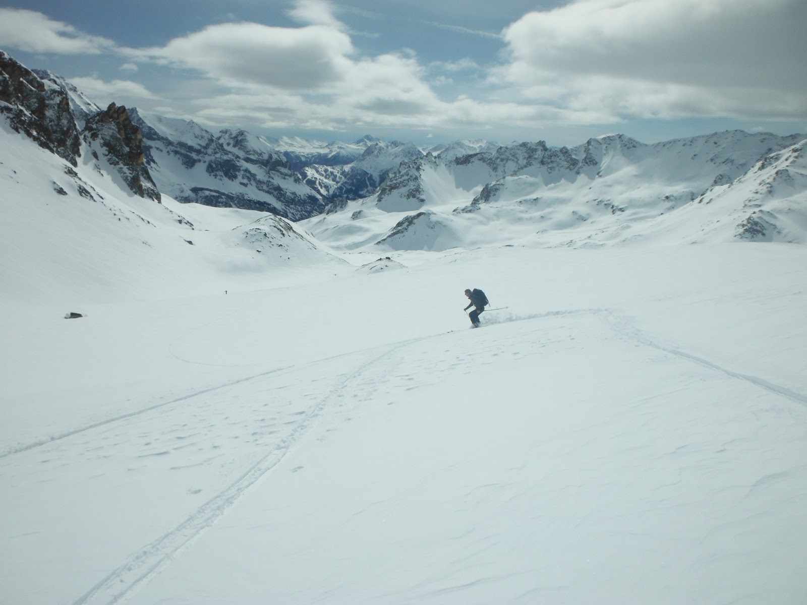
Starting to make up for no downhill ski yesterday.
Jean Marc plying his trade...
...and Frank too
Nice Aiguille
To the left Pointe Balthazar - to the right Pointe Melchoir,
 and, as I found out later from an Italian guide: in the middle
Couloir de la  Gallina. I will have to come back for that  one.
This is where we stopped for lunch...
...for which both Jean Marc and Frank brought a bottle of Graves and some cheese...
Enough sitting around, back to work...

View into Vallée Etroite at the bottom if which we'll find the hut.
Refugio I Re Magi which translates into the three wise men. The three peaks
 dominating it to the West are: Pointe Gaspard (2808m), Melchoir (2948m)
and Balthazar (3153m).
The expedition staff...
Grand Séru at the end of the Vallée Etroite.
This is what it looks like when an avalanche runs out from Pointe Gaspard.
Entrée...
Main course of polenta and sausages... A fitting end to any ski day.


Saturday, April 20, 2013

Hut to hut in the Thabor massif – Day 1/3 (April 12-2013)


On April 12th three friends and I went out on a three day hut to hut in the Thabor massif (french southern alps) that took us in to Italy where we never missed the opportunity to eat or drink something or other…

There were four of us: Laurent, Jean Marc, frank and myself.

We left Annecy at a reasonably comfortable 8 am and took a three hour long “road trip” south through the tunnel of Fréjus into Italy via Bardonecchia and then back into France driving towards our departure valley: Vallée de la Clarée and the village of Névache. While in Italy we of course stopped for coffee even though we were short on time; some priorities are not to be messed with…

Below is our route with day 1 in black, day 2 in yellow and the last day in red (click to enlarge):

Topo map: 3535OT (French IGN reference)
Dominating direction: Day 1: NW – Day 2: NE then SE – Day 3: NW then S
Starting elevation: 1603m
Hut elevation: Day 1: 2185m, day 2: 1780m
Pass elevations : Day 2: 2828 – Day 3: 2645m

Access by car:
From Annecy drive south through Albertville then onto St Pierre d’Albigny  and Vallée de la Maurienne towards Modane till the tunnel of Féjus. In Italy pass Bardonecchia and follow the signs to France then to Vallée de la Clarée and stop at the parking lot at the entrance of Névache (1620m). Trail access is across the road that you passed turning into the parking lot.

Here are some pictures of day 1, I'll post the more interesting days 2 & 3 shortly (click to enlarge):

Last preparations in the parking lot at Névache by my new "skimobile"
From left to right: Laurent, Frank and Jean Marc
Things are getting serious - no more kidding around...
Laurent crossing that bridge when he got there...
In the center a tasty looking line that I may have top come back for...
To infinity and beyond... The first day is all work: 10 miles and
no skiing, it sure felt like infinity.
Finally! Refuge des Drayères in sight
Jean Marc and Laurent arriving to the hut
Sunset on the valley, this was taken from the hut's deck
G'night - Yours truly, hobbit feet and all...


Saturday, April 6, 2013

Glacier and hut of Argentière

The last week-end of the month (March 30 – 31) I dedicated to upgrade my glacier navigation and safety skills. This was organized around a series of drills arranged by guides that are members of the Club Alpin Français. This included drills requiring you trusting the rope enough to hop into crevasses and hanging in your harness…
The weather conditions were particularly heinous day one and only got decent mid-day day two. With about two feet of recent snow, the avalanche conditions were heinous day one and a lot heinouser day two. On the second day in the mid afternoon we heard a lot of mega avies breaking so large that the explosions would echo from mountain side to mountain side. These are by far the loudest and most frequent ones I’ve ever heard, quite eerie...
Spending the night at 9,200 feet was a treat especially as the Refuge d’Argentière is one of the nicer ones (see last few pictures below) in the Mont Blanc massif. In between drills we got to ski really nice snow thanks to the recent snow falls. I did not take pictures of the drills but below pictures show our surroundings as we were “workling”.

Topo map: 3630OT (Chamonix)
Dominating aspect: NE
Starting elevation: 6,400 (Lognan tram)
Hut elevation: 9,200 feet
Col du Tour Noir: 11,600 feet

Access by car:
Drive through Chamonix and at the roundabout just before the village of Argentière, drive into the parking lot of Les Grands Montets. There is a one way ticket that this season costs 26.5 euros.

Here are the pictures (click to enlarge):

Going up the Glacier d'Argentière...
...further up the Glacier d'Argentière
No shortage of crevasses
View of the lower part of Glacier du Milieu that lets you up to the top
of Aiguille  d'Argentière at  12,796 feet
I took this one just for its hanging gloacier that looks like its barely
hanging by a thread. When this one starts breaking appart we'll
have some spectacular serac falls...
This one: Just because...
A beautiful marker to your left just before you make it to the
Refuge d'Argentère
Col des Grands Montets, enlarge to see the turns
These were the conditions on our approach to the Refuge d'Argentière
 late pm on the Saturday
Refuge d'Argentière taken Sunday am when leaving, the conditions improved
View of the common area at the hut. The refuge d'Argentière is stop #1
on the classic "Haute Route", a 6 day ski from Chamonix-Mt Blanc
to Zermatt-Matterhorn

Monday, April 1, 2013

Bold move in Chamonix


The readers of my post of February 5th Vallée Blanche by the slopes of "Le Rognon” may understand how serious this morning’s event is felt to be locally. In the second picture of that post you can see that the top “rocket” on the Aiguille du Midi is telecoms equipment. Well early this morning it was pulled out of its stand by somebody in a chopper. None of the contacted authorities were claiming maintenance or any other reason to lift it off. A crew that happened to be filming up there got below shot of the chopper leaving with it, and in the commotion, hitting the no-name aiguille just north of the aiguille du midi. There is a search out for it now and I’ll get you the full story as soon as I find out more.