Monday, October 8, 2012

Montagne du Sulens

Training requires motivation; a good way I find to keep the eyes on the prize is to scope out ski terrain when running uphill. So today, I went and explored Montagne du Sulens which is the Haute-Savoie version of the Wasatch’s Powder Parks, the place you go to when conditions are hairy but you need to be out and you still refuse to go to the resort. Although this is not exciting terrain, what I do like about this place is that it’s all grassy making it a very likely early season candidate.

Sulens - the "big" side

Sulens - the small end

Why Sulens is not all that avy prone. Told ya its not too exciting...

Winter view one of a Sulens slope

Winter view two of a Sulens slope, it does feel a lot like Powder Parks
...And for your viewing pleasure, here are a few additional pictures taken today from Sulens:

The Mont-Blanc with his characteristic lenticular cloud being blown off by an incoming storm

The glaciers of the Vanoise natural park

la Pointe Percée, highest point of the Aravis massif at about 9000 feet (and a fun  hike)
Typical "alpage" which is the high elevation summer grazing grounds for the alpine cow
...and last but not least: The colors...


Sunday, October 7, 2012

Glacier d'Argentiére

The Argentière Glacier is the glacier lying perpendicular to the Chamonix valley above the village of Argentière. Starting from the Grand Montets resort parking lot this hike involves an ascent of about 3,500 feet.  It is an interesting one to me because 1) it’s a glacier, 2) it’s skiable from the Grands Montets tram, and 3) it offers access to a ski line of classic beauty off the Aiguille d'Argentiére. This is a great way for me to figure out what it takes to get to that line as well as seeing it live. Or rather imagining it live as it will require a few snowfalls before its ready for skiing…


Here are my two american _____ (fill in the blank). YOU ARE CORRECT!
You DID pick ladies? Right!?!?
Aiguille d'Argentiére
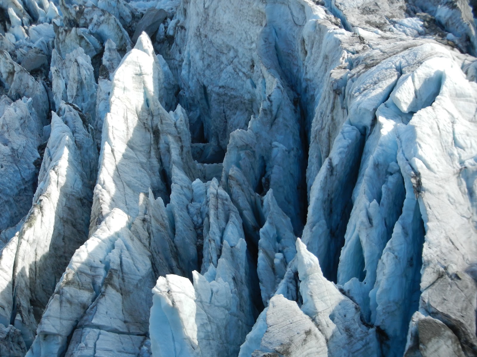
The glacier


More glacier...
For that special glacier feel...

The beautiful pyramid dominating the glacier is Mont Dolent,
a 9014 ft (2748 m) mountain on the  Swiss (Valais) side of the border.

Water running off the opposite old glacier line dating
back to the mini ice age in the middle ages.

The Chalet de Lognan at 6668 feet (2032 m) as seen from above.
It will open again on Dec 20 till early May.

Chalet de Lognan as seen from below.

Friday, October 5, 2012

A training bonus

Every now and then you get a bit more than a work out running up a hill with an oversized backpack. Last year at about this time, in the Massif des Bornes, I took some wild life pictures at about 1,000 feet above the Larrieux hut which is still open. This time I got a few really nice shots of the Ibex. So without further ado and for your viewing pleasure (click to enlarge):

The ridge line at Crete de Tervelles, if you look carefully you see an ibex in the center

For that backountry.com feel...

A younger one, not fully "logo ready".

Here is the younger one with mommy...
WE ARE FA-MI-LY...

The second family portrait.


Thursday, September 27, 2012

First Snow!


Let me correct that: First snow down low. Today on my “training hike” up to crête des Tervelles (Massif des Bornes) there was a great training motivation booster in waiting as I got up: Snow! I am here talking about snow below the 5000 feet mark . This hike starts at 735 m (2,400 feet) and tops out at 1,775 m (5,800 feet). Well just a bit over an hour into this thing Skadi and I were in snow. Here are the pictures (click to enlarge):
View of the Massif des Aravis that tops out at about 9,000 feet. The higher summits are all in the clouds on this picture.
This almost looks skiable today... The snow covered summit in the middle tops out at about 7,000 feet.
Here the snow goddess is enjoying her first contact of the season and since this is still only September...

Thursday, October 13, 2011

Wild life

No, it’s not what you think; this is actually about animals, of the type you find in nature… I was up in the Massif des Bornes close to the Larrieux hut which recently closed for the season. This the kind of place that has almost no traffic in high season so now it’s absolutely deserted, if you're up there you’re probably the only one on the mountain. What’s good about this is that you end up seeing some wildlife especially since Skadi finally knows how to go into stealth mode instead of chasing them all away before I make it around the corner. So here are a few pictures of what I saw today (click to enlarge).


Small heard of Chamois (more on those below)


This is the Alpine Ibex (Capra ibex) or in french Bouquetin des Alpes. This is the fattest they get, through the winter they will loose up to half their weight so if they aren't overweight now they won't make it through the winter.


Same guy wondering why all the pictures?


This is the Chamois. They are goat-antelopes that are very common in the Alps but in a lot of other European ranges as well including the Balkans, the Carpathians and the Caucasus. These guys too overeat before they more or less stop for the winter.


A nice wiew of la Tournette from "behind" as in not from the lake of Annecy.

Saturday, October 8, 2011

La Crête des Grands Oct. 6 -2011

Went back to le Tour for a hike this time past Albert 1er hut (see the “Refuge Albert 1er” post on 9/25) and onwards an upwards to Crête des Grands (10,148). This is a 6,000 feet hike with a heinous last 2.000 feet in interminable steep and unstable rock fields. There is absolutely no trail and just for the fun of it, every once in a while the sub ridge will take you to some spectacular cliff out just so you have to down climb back and start over till you get a rout that actually works. By the time you’re on top and if you miss enough times first, like I did, then you’re wiped out just in time for a never ending 6,000 feet down. I did this one on this day because it was the last day in a closing weather window that would probably push this back, at least as a solo job, till next year. It worked out remarkably well as I had sun till noon (time I summitted). Then the clouds started moving in as I was going back down, and by the time I got gas in Chamonix it started raining (snowing on top)! I was expecting that to start the next day not within 30 min. of me being back, so sometimes the weather forecasting does work out pretty darn well.
Here are the pictures (click to enlarge).
On the way up towards glacier du Tour


You think they saw me?


It is getting good now...


From the top: View into Switzerland (see Matterhorn far left)


From the top: View of the lake d'Emosson


On the way back: Albert 1er with the glacier for backdrop


Company for lunch at the hut (he/she is tagged)


Glacier and Aiguille du Tour on the way back


Friday, October 7, 2011

Le Montevers Oct. 4 - 2011

Le Montevers is best translated into the back of the mount which of course fits here since we are on the “backside” of Mont Blanc overlooking the largest glacier in the massif: “La Mer de Glace”. We hiked from the village of “Les Bois” in the valley to Montevers and then onto the “Signal Forbes” from which the view spans from Mont Blanc – Chamonix - Mer de Glace.

Here are the pictures (click to enlarge).

The Montevers cog train that comes in from
Chamonix, and no, we did NOT take the train up...


More infrastructure - the hotel opposite the
train stop and overlooking the glacier.


The glacier himself...


Aiguille du Dru (12,313)